Canals of Bangkok
Many tourists tend to overlook Bangkok’s canals and river, which is a real shame because exploring the city’s ancient waterways offers an entirely unique perspective of the Thai capital. Back in the 19th century, the vast network of canals even earned Bangkok the nickname ‘Venice of the East’. Taking a tour along these historic waterways provides a fascinating glimpse into the city’s rich heritage and culture.
The History of Bangkok Canals
The history of Bangkok’s canals, also known as “khlongs,” dates back to the early days of the city’s foundation. Bangkok, originally called “Krung Thep” or the “City of Angels,” was established in 1782 by King Rama I as the new capital of the Kingdom of Siam (now Thailand). The strategic location of the city, situated along the Chao Phraya River and its network of canals, facilitated transportation, trade, and irrigation, making it a thriving center of commerce and culture.
The canals were initially dug by hand by the labor force, including soldiers and convicts, under the direction of King Rama I and subsequent monarchs. These waterways served multiple purposes, such as:
Transportation. Canals were the primary means of moving people and goods around the city, especially during the early days when roads were underdeveloped.
Irrigation. The canals were essential for maintaining a steady supply of water for agriculture, helping to support the city’s population and surrounding farmland.
Defense. The intricate network of canals served as a defensive measure, as they acted as natural barriers and allowed for easier monitoring of the city’s borders.
Flood Control. Bangkok is situated in a low-lying delta area, and the canals helped manage floodwaters during the monsoon seasons.
During the 19th and early 20th centuries, Bangkok’s canals were the lifelines of the city. However, with urbanization and the development of road infrastructure, many of the smaller canals were filled in to create roads and accommodate the growing population. As a result, the once-extensive canal network started to shrink.
Canals Today
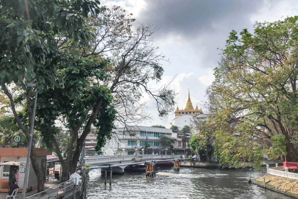
In modern times, while many canals have been filled or narrowed, some major ones, such as Khlong Saen Saep, Khlong Phadung Krung Kasem, and Khlong Banglamphu, still remain in use. Khlong Saen Saep, in particular, has become an important transportation route, serving as a busy waterway for commuters and tourists alike.
Although many of the old canals have made way for roads and highways, several miles worth still remain to the west of the city in Thonburi, and, to a lesser extent, through old Bangkok. The best thing is that many lesser Bangkok attractions lie along the canals, including an array of floating markets, while big sights, like Wat Arun on the river, are also apparent.
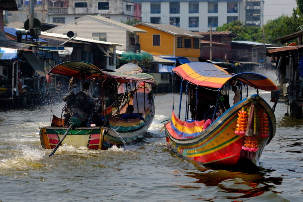
Tourists can tour these canals via long-tail boats and escape the heat of the concrete jungle at any time of day by heading for one of the piers along the canals, or, indeed, on the river. The Tha Chang Pier near the Grand Palace is the best-known and one of the most accessible piers and trips go from here for 90 minutes or so.
The best of it is you get to sit back with the wind in your face and see something that most others never get to see; even the majority of Bangkokians, who would consider these ancient waterways dirty and not worth their time.
✨ RECOMMENDED TOURS ✨
Thonburi Canals
Thonburi is a district in the west of Bangkok, across the Chao Phraya River from Silom, and is strewn with ancient canals that are still a way of life there. In fact, the best way to get around Thonburi is by boat as this form of travel is invariably more direct, plus the area is quite large, and getting about on foot is a pain.
Thonburi also gets badly congested through the best part of the day and there is a lack of footbridges. Thus, getting on a tour of the canals around this area is the best bet. You can pick up Thonburi canal tours from the east side of the Chao Phraya River at Tha Chang Pier, which is the easiest one as it is near the Grand Palace. Tha Tien Pier and the pier at the Oriental Hotel (Silom) are also possible.
These trips go for up to two hours and take in all the major sights of Thonburi, including along the Bangkok Noi (small) Canal, Bangkok Yai (big) Canal, Chakphra Canal, and the Daan Canal. The cheapest way is to do a trip without any stops and always be sure to bargain.
Mitchaophraya Travel Service is one such service that takes in parts of Thonburi, leaving from Tha Chang Pier. There are two tours available, with the one-hour one doing Bangkok Noi Canal and Mon Canal, and the 90-minute one inclusive of Bangkok Yai Canal. You also get to visit a floating market – Thonburi Floating Market during the week and the better Taling Chan Floating Market on the weekends – as well as the Royal Barge National Museum and Wat Arun (the Temple of Dawn) on the river.
A much cheaper option is to take the public boat service that goes from Tha Chang pier every 30 minutes between 06:30 and 11:00. Trip price is very reasonable and you get to see one of the floating markets and an orchard.
Chao Phraya River
If you just fancy a blast down the Chao Phraya River, the best bet is to get on the Chao Phraya Express Boat, which is essentially a public river bus that goes up and down the river all day long. You can go from Wat Rajsingkorn down to Nonthaburi, taking in many of the main attractions in the Rattanakosin area, including the Grand Palace, and Wat Arun.
In addition to this service are ferries that just go across the river and back; say, from the Grand Palace over to Wat Arun or to Thonburi. These cross-river services operate from most piers on either side and they go every five minutes or so throughout the day and cost peanuts.
There are also tourist boats that cost a fair bit more but include English commentary for eager beavers. These boats are a bit more comfortable and less crowded than your typical ferry-style boat and they use different piers. They run every 30 minutes to 15:00 and you can buy single tickets or an all-day pass.
Another option for touring Bangkok’s canals and river, and one which often gives the most pleasure, is aboard a long-tail boat. You can charter these from any pier and can often negotiate good deals directly with the captain for a longer trip. Trips usually go via Wat Arun, then onto the Royal Barge Museum, and a floating market. Going from Tha Chang Pier or Si Phraya Pier (Silom) is the best bet.
Popular tours go from Si Phraya pier either along the Chao Phraya River or into Thonburi, the latter of which is a two-hour tour and includes a visit to an orchid farm and Wat Sai Floating Market. The Boat Tour Centre runs these trips out of Si Phraya Pier.
Khlong Saen Saep Canal
Khlong Saen Saep Canal, a historic waterway snaking through the bustling metropolis of Bangkok, offers a captivating glimpse into the city’s rich heritage and everyday life. Serving as both a crucial mode of transportation and a living connection to the past, this canal has been an integral part of Bangkok’s landscape for centuries.
As water taxis and long-tail boats ply its waters, passengers are treated to a unique perspective of the city, passing by traditional wooden houses, lively markets, and ancient temples that line the canal’s banks. Despite the modernization of Bangkok, Khlong Saen Saep remains a vibrant hub of activity, embodying the harmonious blend of old and new that defines this vibrant city.
Frequently Asked Questions
What is the famous canal in Bangkok?
The most famous canal in Bangkok is the Chao Phraya River. As the city’s main waterway, it has played a vital role in Bangkok’s history, serving as a major trade route and facilitating transportation between different parts of the city. The Chao Phraya River is not just a water channel; it also holds cultural and symbolic importance for the people of Bangkok, and many important landmarks and attractions are situated along its banks.
How many canals are in Bangkok?
Bangkok boasts an extensive network of canals, more than 1680 in total. The exact count of canals in Bangkok may vary over time due to urban development and changes in land use. Historically, there were hundreds of canals crisscrossing the city, which earned Bangkok the moniker “Venice of the East.” While some of these canals have been filled in or narrowed over the years to make way for roads and buildings, many significant ones still remain and continue to be an essential part of the city’s landscape.
Why Bangkok has so many canals?
First of all, the city’s geographical location in a low-lying delta region with an intricate network of rivers and waterways resulted in the natural formation of canals. Plus, the canals served multiple practical purposes, such as transportation, trade, and irrigation. Before the development of modern roads, canals were the main means of moving people and goods around the city.